
3D, LiDAR & Point Cloud
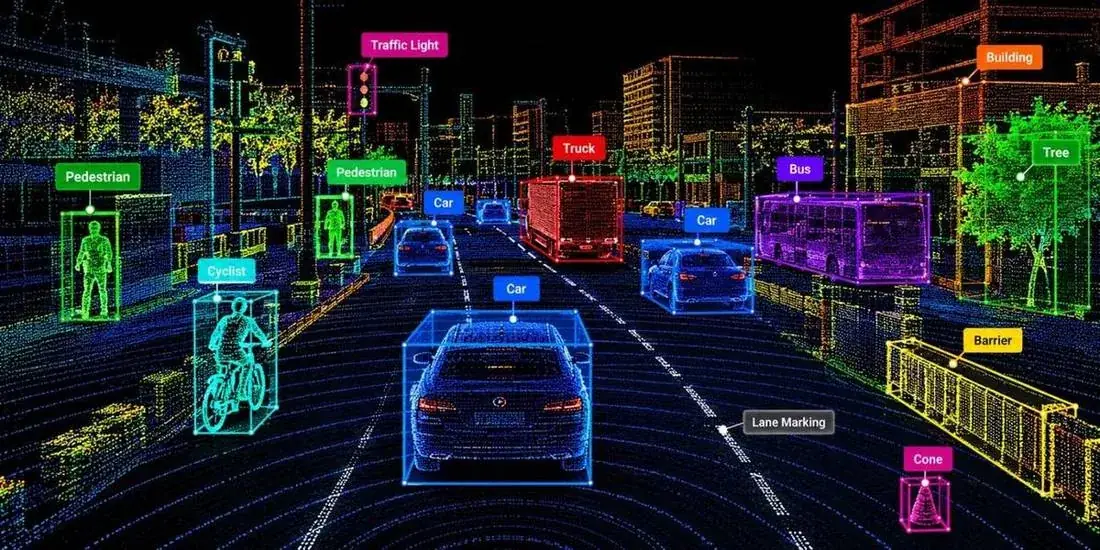
Depth-aware labels for LiDAR, radar, RGB-D, and multi-view data, kept consistent across frames and sensors.
What we annotate
Common task types. Every project follows guidelines agreed with you at scoping.
3D cuboids
Boxes with size, position, and heading for objects in 3D space.
Point cloud segmentation
Assigning every point to a class such as road, vehicle, or vegetation.
Sensor fusion
Aligning camera and LiDAR labels so they describe the same object.
3D object tracking
Keeping object identities consistent through a sequence.
Depth & distance
Labelling range and depth cues for perception models.
Scene & map annotation
Marking lanes, surfaces, and structures in 3D scenes.
Used across industries
Where this service is most often applied.
AI Needs More Than Data.
Talk to our team about annotation programs, datasets, and enterprise AI infrastructure tailored to your domain.